
March ‘island’
Two walks
1 (43) Doddington & Wimblington – being developed
2 (44) March – if you would like to help with this walk, please get in touch.
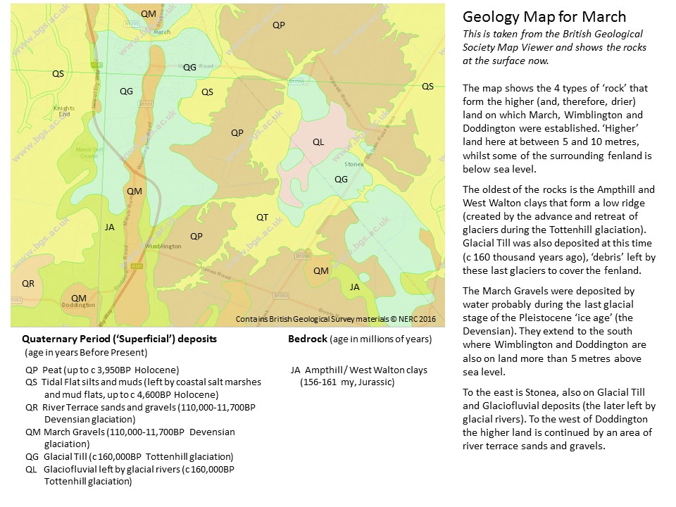
For a key to the geology see the geology map below and the British Geological Survey map viewer.

The town of March is situated on a ‘fen island’ of higher land that rises above the low-lying fenland that surrounds it. Although some of the island is between 5 and 10 metres above sea level, much of the town is lower. To the south of March, the nearby ‘island’ of Wimblington and Doddington also rises above 5 metres.
The River Nene (old course) flows through the centre of the town and was the main transport route until the mid 19th century. The Fen Edge Trail will link with the current Riverside Walk and Riverside Nature Trail and with the Woodman’s Way between March and Wimblington.


For info on local talks see The March Society website.
The surrounding fenland to the east of the island is mostly peat, formed from undecomposed organic material that accumulated in freshwater, waterlogged conditions. ‘Bog oaks’ occur as in much of the fenland peat. To the west, the surface layer is made up of marine silt deposited when sea level rose and the area consisted of brackish water in a ‘tidal flat’ environment.
These areas of higher land are formed because the bedrock (mudstones of the Ampthill or West Walton clays dating from Jurassic times c 156 to 161 million years ago) forms low ridges that stand above the general level of the surrounding fenland. Recent studies suggest that these ridges are the result of glaciers advancing and retreating during the Tottenhill glaciation (c. 160 thousand years ago), the last time that glaciers covered the fenland. These clays are covered ins some places by Glacial Till, the March Gravels or River Terrace gravels, all recent material that is more resistant providing protection from erosion. The Glacial Till is made up of several types of rock (including flint, chalk and sand) that was carried along by glaciers, often from many miles away, during the Tottenhill glaciation (c. 160 thousand years ago) and then left behind when the ice retreated. The March Gravels are sands and gravels deposited during the Devensian glaciation (from 110,000 to 11,500 years ago) and the River Terrace gravels were left by flowing water, again during the Devensian.
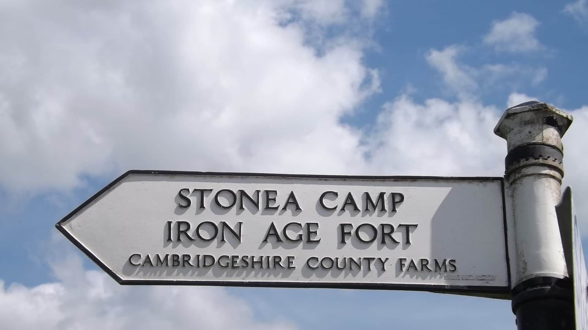
Although still at risk of flooding at various times, this strategic area of slightly higher ground would have had great value as shown by its history. For example, in 1981, a hoard of 872 Iceni silver coins, thought to date from the end of the iron Age and now mostly kept in the British Museum, was found at a farm in Field Baulk, March. To the east of March there is another area of glacial material providing dryer ground (although less than 5 metres above sea level) on which Britain’s lowest Hill Fort (at 2 metres), Stonea Camp, is located.
 decorated with Snettisham Carr, an orange sandstone from Norfolk")

")


© Cambridgeshire Geological Society