Landscape and Geology
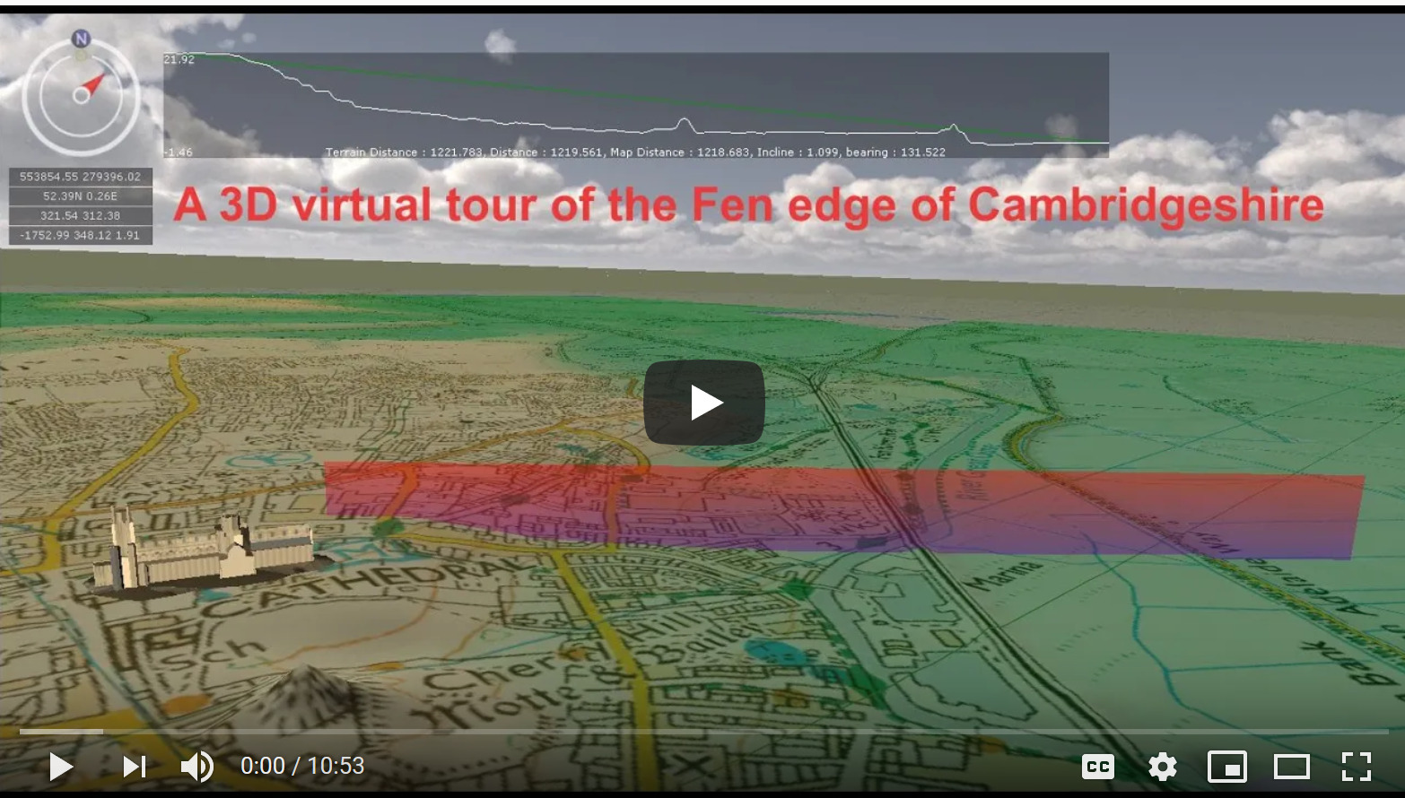
A ‘flyover’ of the geology of the Isle of Ely
For a fascinating ‘flyover’ of the geology of the Fens, see this virtual tour around the Isle of Ely (using GeoVisionary software) produced by Cranfield University for us.
Understanding the geology of the Fen Edge (or anywhere else) needs a journey into the past to discover a fascinating series of changing environments over millions of years. The many different types of rock are fascinating and include those that contain rare and important fossils and others that are made almost entirely of the remains of plants or animals (including the Chalk and some limestones). The more recent deposits such as peat, tidal silts and clays and gravels, are also part of the geology (not to be confused with the surface covering of soil).
Traditionally, rocks and other geological material are classified by dividing them into two main types depending on when they were formed and this is particularly helpful in this area as the two are very distinct:
1. The ‘Superficial‘ deposits are material that has been left in the last (approx) 2.6 million years i.e. the Quaternary Period – known as the current ‘Ice Age‘ (although it includes warm intervals as we are experiencing now to an extreme degree). In the fenland area these include Peat, Silts, Clay from tidal mudflats and salt marshes, River Terrace Gravels and glacial deposits such as Glacial Till (which used to be known as Boulder Clay).
2. The ‘Bedrock‘ is the general name for all the older material – some of which can be relatively hard, such as limestone or sandstone, and some relatively soft such as the Oxford, Ampthill and Kimmeridge Clays. All of the bedrock at the surface in this area is Sedimentary rock (formed from particles of material that have been compacted). Underneath the sedimentary formations, there are extensive bands of much harder, Igneous, rocks. These are formed when molten magma solidifies and forms crystalline rock, either during volcanic activity (at the surface) or plutonic intrusions (deeper down). At Warboys, a borehole found volcanic rock at a depth of about 150m.
Obviously, through time, Superficial deposits (if they are not eroded away) will become Bedrock – an example is Peat which would gradually become compacted under pressure to form Coal. In many places, any Superficial deposits have been eroded and the Bedrock is at the surface, whereas in other areas significant younger material still remains. The latter includes the large fenland areas covered by Silt or Peat and many of the hills on the fen edge that are covered in a thick layer of Glacial Till.
In geology maps (such as those produced by the British Geological Survey whose data we use in our maps), it is the surface geology that is shown but the online BGS Map Viewer also gives information on the underlying bedrock if covered by the Superficial deposits.
The Bedrock (the older rock ‘underneath’)
Underlying the Cambridgeshire Fens, there are layers of rock (the ‘Bedrock’) that date back to the Jurassic and Cretaceous Periods – a time famous for its dinosaurs and huge marine reptiles such as plesiosaurs, pliosaurs and ichthyosaurs as well as smaller creatures such as ammonites and belemnites, the fossils of which are well known.
In this region of England, due to tilting of the land, mostly during past ‘mountain-building’ periods, the Bedrock at the surface is generally youngest in the southeast and older in the northwest. The oldest of the county’s rocks date from the Jurassic Period – their ages range from c. 175 to c. 150 million years (the Middle and Upper/Late Jurassic). The oldest are limestones (better known in Lincolnshire and Northamptonshire) such as the famous ‘Barnack’ limestone but they are mostly clays – the Kimmeridge Clay, Ampthill Clay and Oxford Clay (used extensively for brick making). There is also an outcrop of younger Jurassic limestone, the Upware limestone, near the southeastern edge of the Fens. The younger rocks, to the southeast range in age from c. 120 to 85 million years (Cretaceous Period). They include rocks such as the Chalk, Gault Clay and Lower Greensand (Woburn Sands).
The recent (‘Superficial’) material
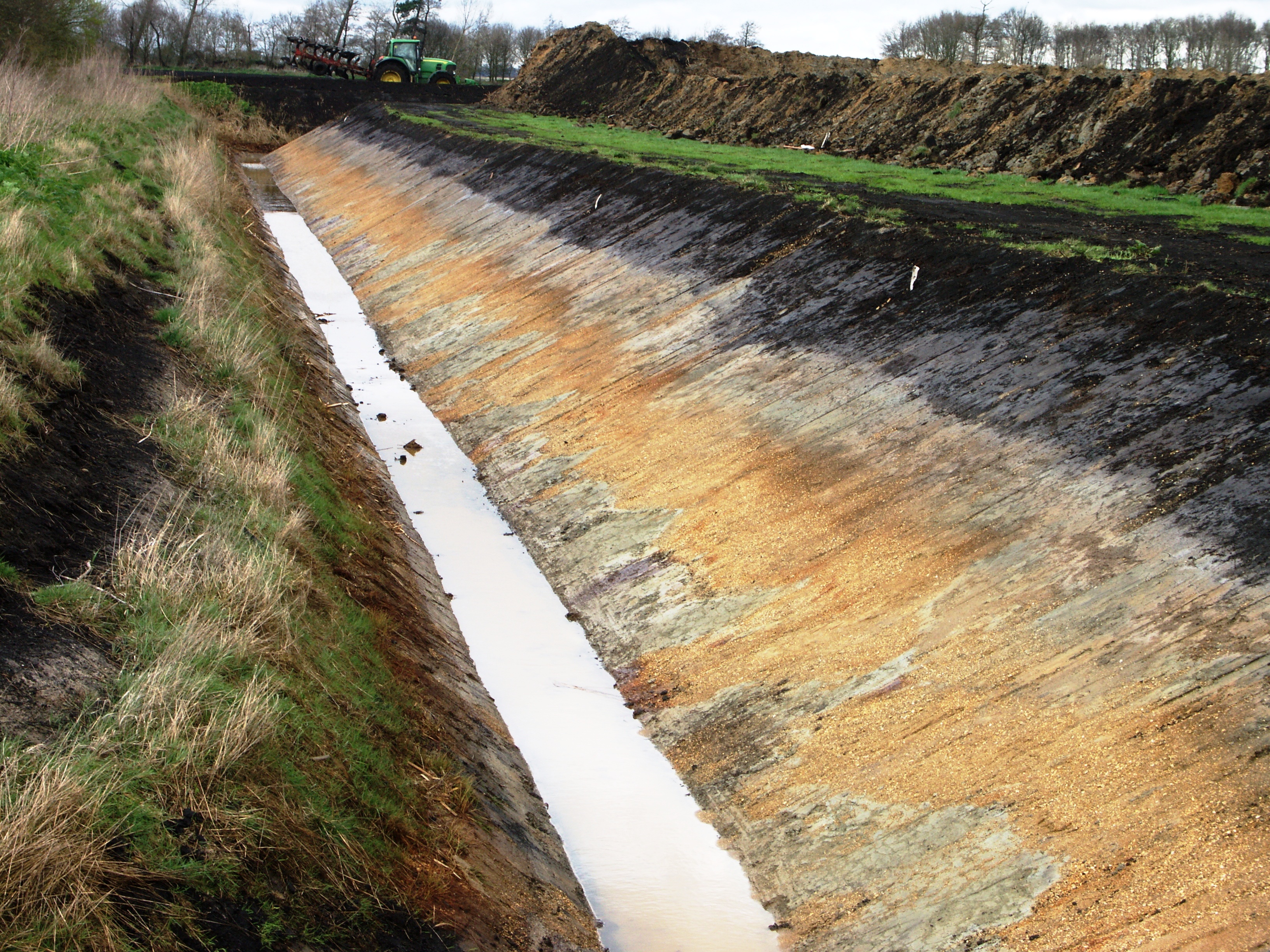
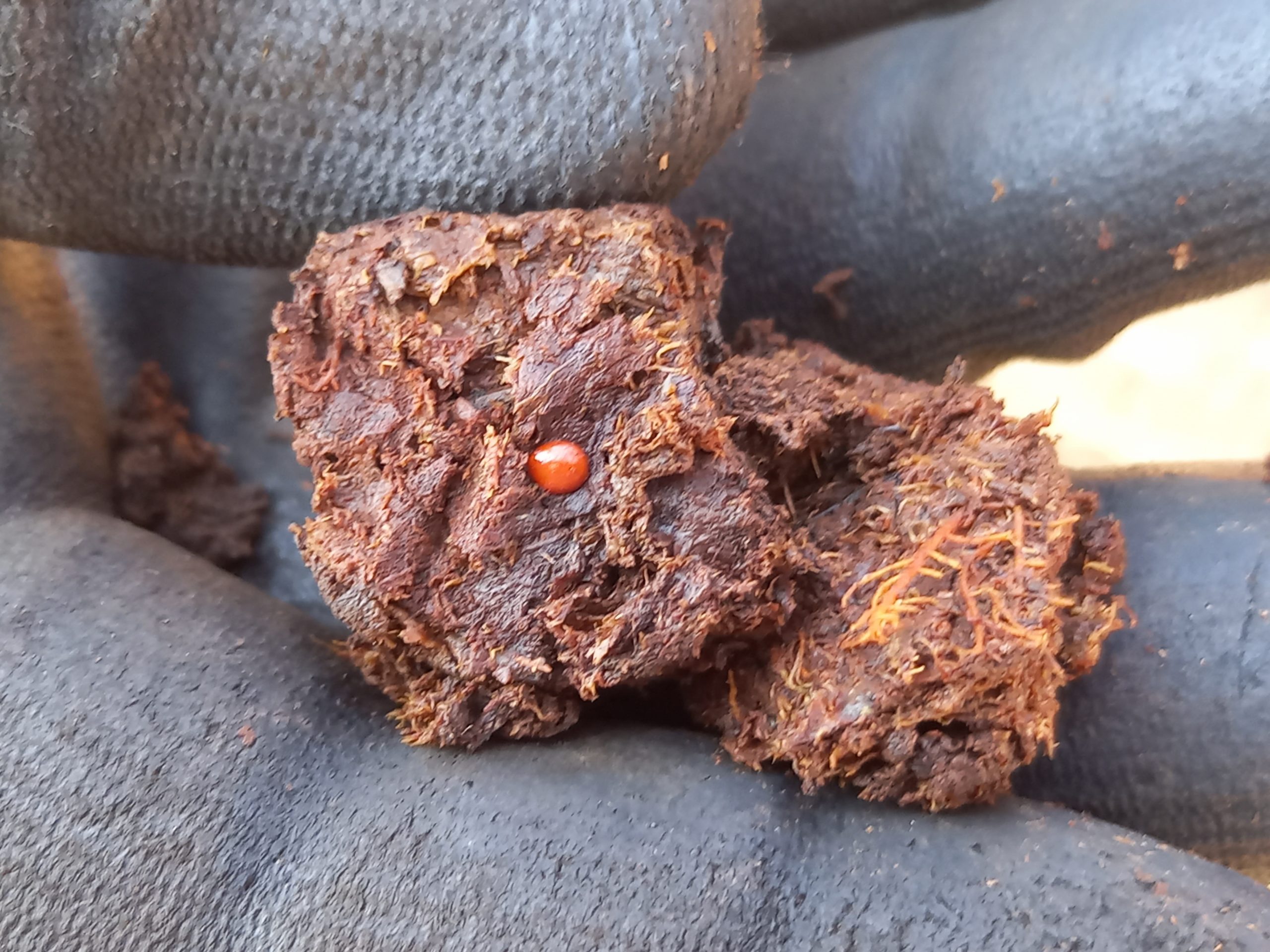
The Quaternary Period started about 2.6 million years ago with the onset of the Pleistocene glaciations. These deposits include Alluvium (from rivers), River Terrace gravels, marine Silt and Clay, Peat (formed in freshwater) and material left after the glaciations. The latter, includes Till, previously called boulder clay due to its general clayey nature (in this area), and glacial lake and river deposits such as gravels. The glacial deposits on the south eastern edge of the fenland are up to about 460,000 years old (the Lowestoft till from the Anglian glaciation, when the ice sheet extended south to the Thames Valley), but those in the fen basin and to the west of it, are possibly younger, about 300,000 years old, from the Wolstonian glaciation. They may even be from the Tottenhill glaciation, when a tongue of ice extended down almost as far as Cambridge. Studies are still being carried out to ascertain the provenance and age of what is currently mapped by the BGS as Oadby Till. Most of the Peat and Tidal silts and clays are less than 11,700 years old (Holocene) and the river Alluvium is still being deposited, although now in relatively small quantities.




Geology Map
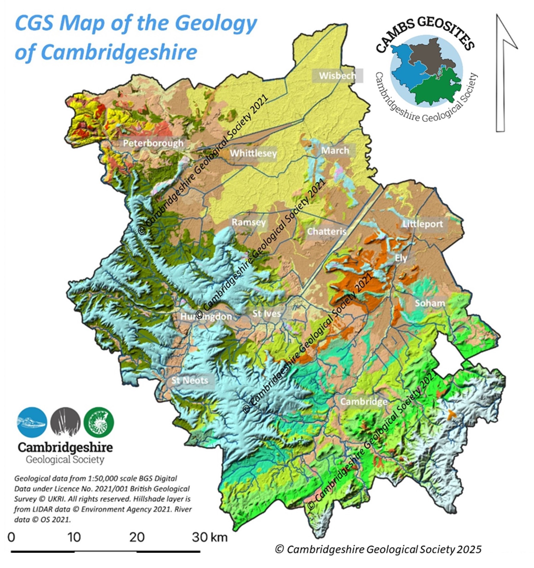
This map (containing data from the British Geological Survey) shows the basic geology of the area. It also includes hillshade data showing the topography. The relationship between the geology and height of the land can be seen, particularly near the Fen Edge.
The different colours represent the geological material that is at the surface today. The cream, yellow, brown, orange and blue areas are where the recent (‘Superficial’) deposits remain. The lighter green band of bedrock running from the south to the east of the county shows the Cretaceous bedrock and the dark green and bright orange areas to the northwest show the Jurassic bedrock.
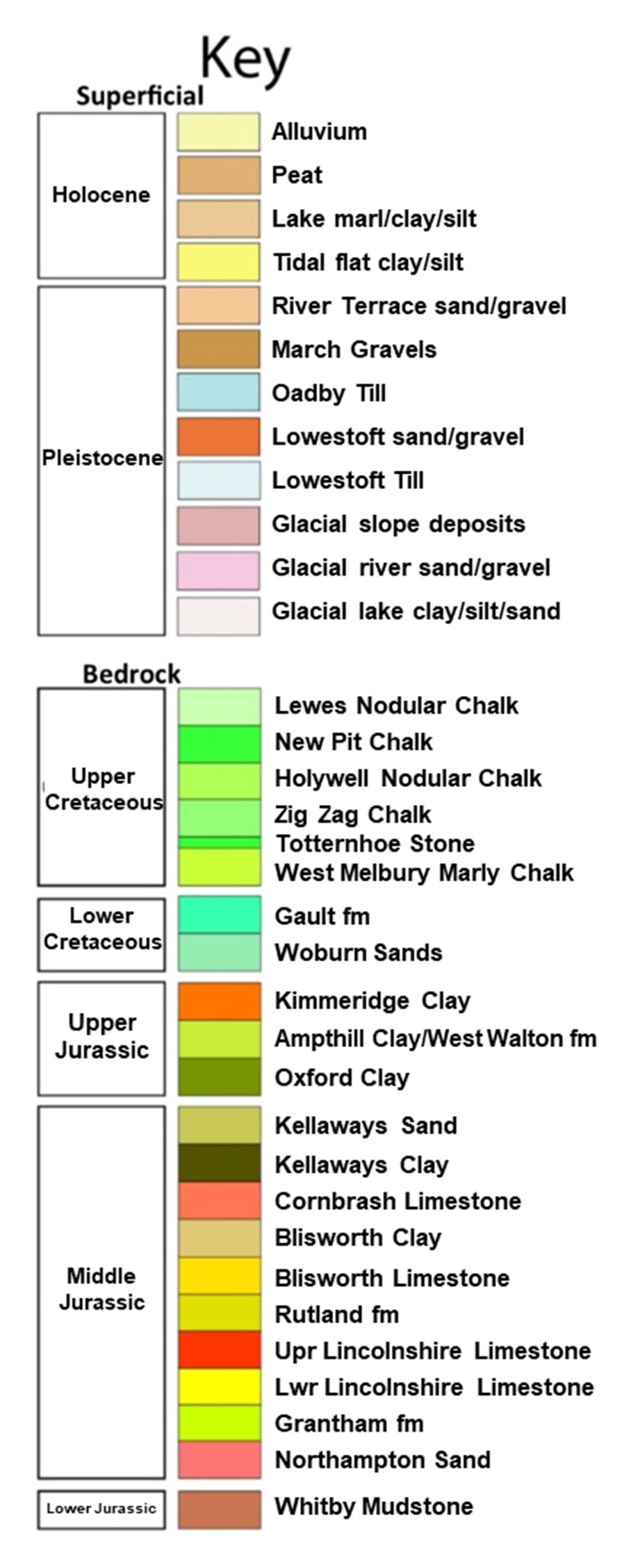
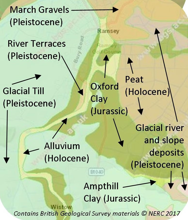
Example of geology maps in walk leaflets


For more information on the geology of Cambridgeshire see the
Cambridgeshire Geological Society website.
For a closer look at the geology of any particular place, see the
British Geological Survey map viewer.

© Cambridgeshire Geological Society
