Five walks
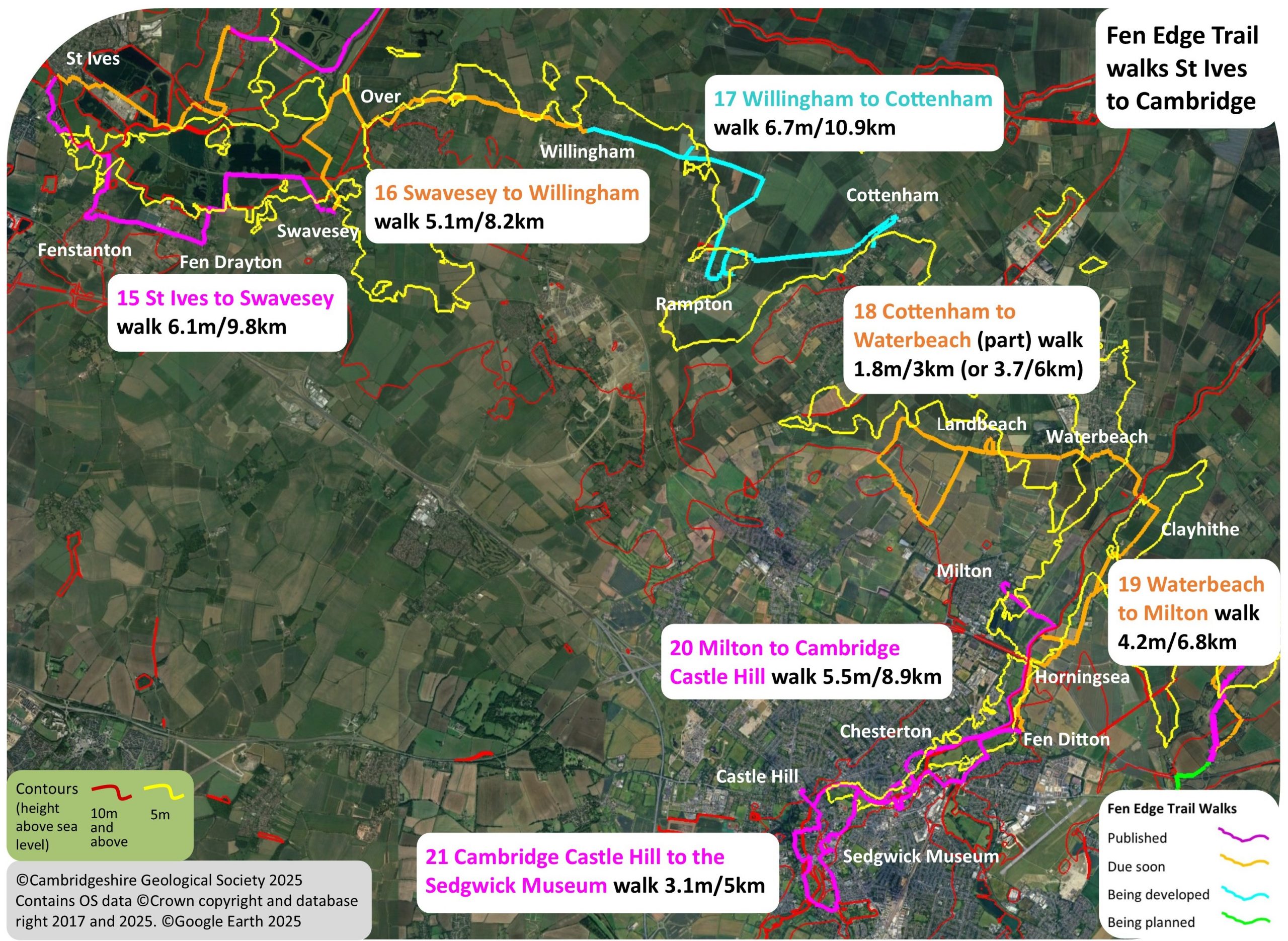
The last three walks on the journey between St Ives and Cambridge plus two additional walks in the southern part of the city.
1 (19) Waterbeach to Milton – due 2026
2 (20) Milton to Cambridge: Castle Hill – published
3 (21) Castle Hill to The Sedgwick Museum of Earth Sciences – published
Download Walk Guides below
Plus two additional walks in the south of Cambridge to visit Trumpington, Cherry Hinton and the lower slopes of the Gog Magog hills taking in two Local Geological Sites, East Pit and Nine Wells.
Walk 1 (19): Waterbeach to Milton
Due 2026
4.2 miles (6.8 km) Walking guide time 1.5 hours plus stops
From Waterbeach, the walk takes you to Clayhythe on the River Cam and then upstream through Horningsea. Crossing the river again, you walk up into the village of Milton.




Landscape and Geology
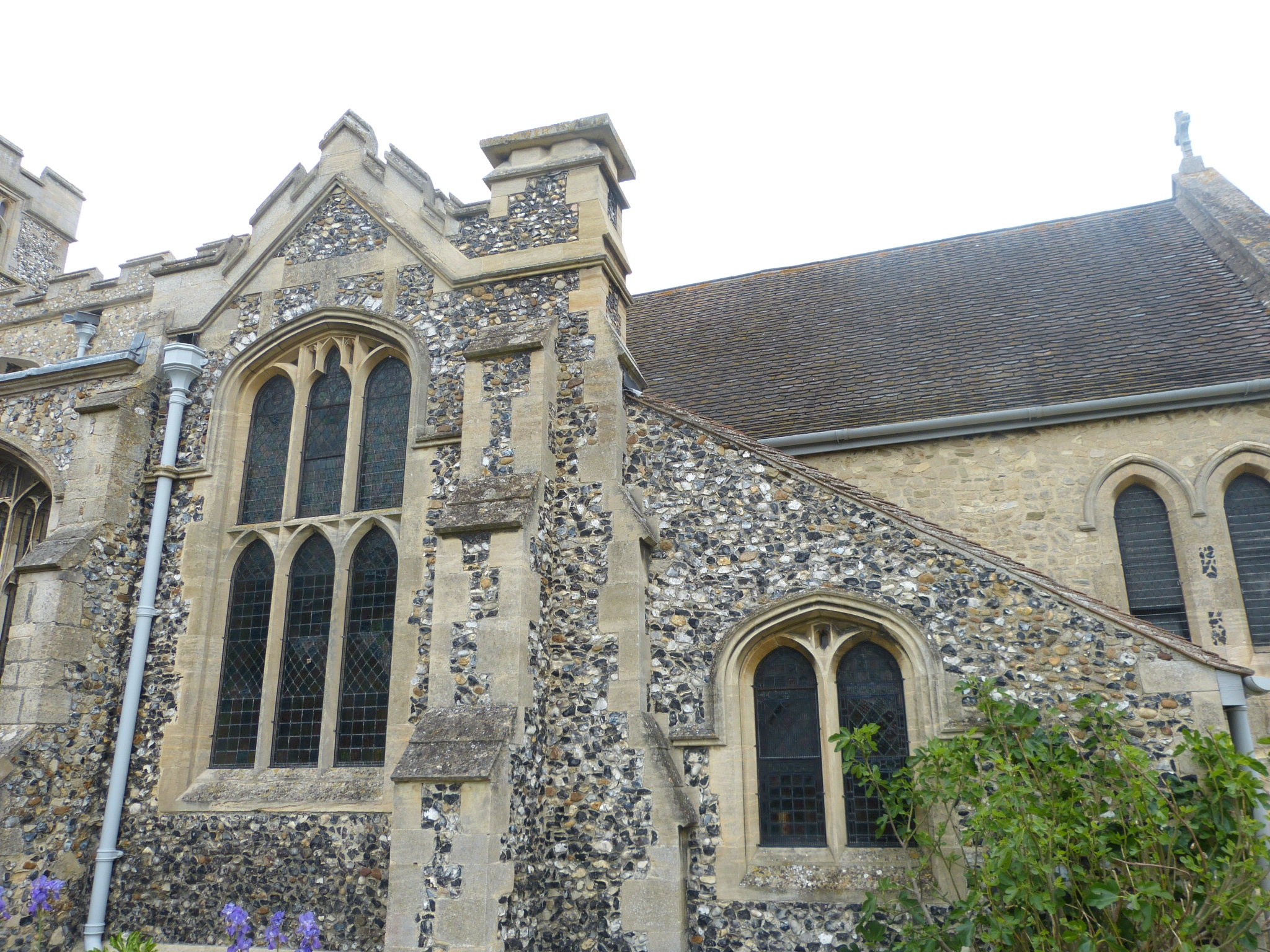
The walk starts on the Gault clay and then takes you below 5m across the wide band of Alluvium along the river, dropping to 4m, the lowest point on the walk, for the first time. Passing back into the Gault, where Clayhythe is situated, you then cross a slightly higher area of Chalk before more Gault. As you approach Horningsea you reach a low area where the bedrock is covered by the sands and gravels of the 2nd Terrace of the Cam. The main part of the village is reached once you return to the higher Chalk, rising to 13m, before you walk back to the river Alluvium. There is a small patch of 2nd Terrace gravels and then a thin strip of Gault clay before reaching the Alluvium and dropping below 5m again. Once over the lock, there is more Alluvium and you reach 4m again as you turn away from the river. The walk finishes on the 2nd Terrace gravels which underlie Milton, reaching the highest point of the walk, 14m, at the end by the church.

Walk 2 (20): Milton to Cambridge. Castle Hill
DOWNLOAD WALK GUIDE
‘I just love the river here and all of the history that you find along it’
The route: ‘along the River Cam to the ancient castle on a hill’
5.5 miles (8.9 km) Walking guide time 2.5 hours plus stops
This is the last walk on the Trail between St Ives and the fen edge settlement that became the city of Cambridge. Having arrived in Milton from Waterbeach, the Trail returns to the River Cam to follow it upriver again – as it flows slowly out of the city on its way north to join the River Great Ouse. From the village (now suburb) of Milton, the walk passes Milton Country Park to arrive at the river near Baits Bite Lock. A leisurely stroll up the river takes you along the tow-path with its many pollarded willows, past rowers gliding through tranquil waters, including those of the famous ‘Bumps’. There is much of historical interest as you walk through the ‘village’ of Chesterton and past riverside meadows. The river has eroded the Gault clay at the base of the Chalk and you pass sites that were dug for clay for brickmaking, coprolites, or the extensive river gravels. Finally, you reach the Medieval trading heart of the town at the wharves, the main docks for merchants transporting cargo along the river to the sea and beyond. Approaching the ancient river crossing, the view ahead from the bend in the river, near Jesus Lock, would once have been dominated by Castle Hill, with its Roman encampment and, later, its Norman Castle, strategically positioned to oversee all river traffic into the town. There are still iconic views over the modern city to the south from Castle Mound.


Landscape and Geology
Apart from the ascent up Castle Hill at the start of the walk, the main feature of the topography in this area is the low lying, relatively flat valley of the River Cam with its succession of (now barely discernible) terraces. The river here flows approximately south west to north east, at a low gradient. The river is fed mostly by chalk streams, known for their clear water, but the water quality is affected by various pollutants, even before it reaches the city. Its current course runs along the edge of the Gault clay. The walk starts on the 2nd Terrace and crosses the narrow band of the 1st Terrace before reaching Alluvium which it stays on for most of the route. It skirts an exposure of Gault clay and Chalk opposite Fen Ditton and crosses a narrow band of Gault before and after passing through Logan’s Meadow Nature Reserve. Finally, it crosses narrow bands of Gault and 2nd Terrace gravels before climbing the Chalk of Castle Hill to reach the small patch of 4th Terrace gravels on the top.


Walk 3 (21): Cambridge Castle Hill to Sedgwick Museum
DOWNLOAD WALK GUIDE
‘this walk captures everything I love about Cambridge – a glorious ‘town and country’ mixture of human and natural history’
The route: ‘through the fen edge town that became one of the world’s most famous cities’
3.1 miles (5 km) Walking guide time 1.5 hours plus stops
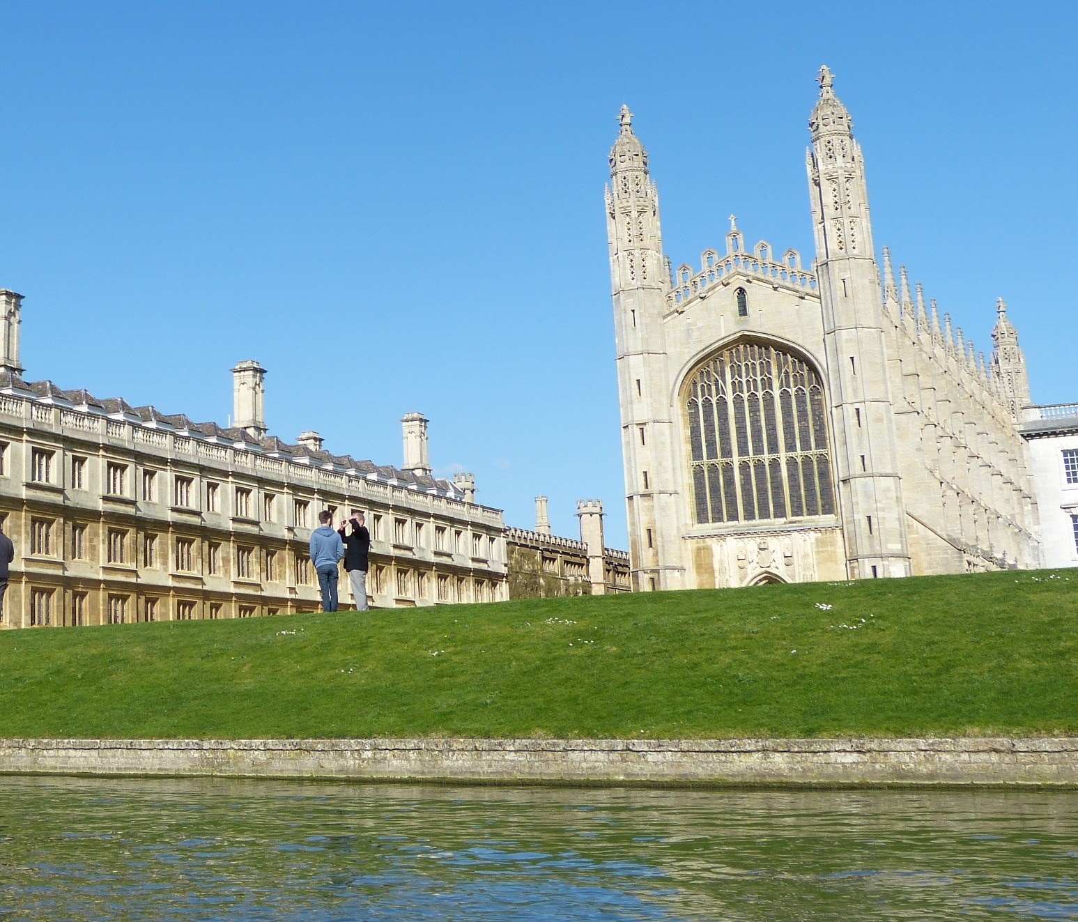
Known for its location on the River Cam and its nearby Chalk hills, Cambridge is still very much a fen edge city. Arriving in Cambridge from the north, along the River Cam, the Trail reaches the distinctive landscape feature of Castle Hill, the site of an early, and highly strategic, settlement that developed to become one of the world’s most iconic cities. This walk takes you down from the hill and across the ancient Magdalene Bridge, before winding along the river valley, past several colleges and providing quintessential views of the ‘Backs’. After passing through the characteristic ‘fens’ that still survive along the Cam, it finishes at the internationally important Sedgwick Museum of Earth Sciences. Guiding you through what is now a mostly hidden landscape, the walk takes you back in time, giving a glimpse into the city’s past and the natural history of the area, from ‘Ice Ages’ to sub-tropical swamps and fenland rivers. You will discover how its natural character still filters through, seen in the riverside meadows, the numerous water channels, the subtle changes in the height of the land and even in the building stones used in many of its famous buildings.




Landscape and Geology
The ‘high’ top of Castle Hill contrasts with the flat river terraces and floodplain in the valley of the River Cam. Except for small areas of Chalk and Gault on Castle Hill, and Gault by Vicar’s Brook, the bedrock on this walk is covered by much younger, river deposits. Now flowing south west to north east through the city, the river has changed its course a few times over the last c.500,000 years, during the Pleistocene ‘Ice Age’. The forces of ice and water have created a gradually deepening river valley with an often-changing pattern of channels. This has left a complex collection of sands and gravels (with some clay) that form a series of River Terraces. Four terraces have been broadly identified, representing different stages in the river’s history, with the oldest (the 4th) lying furthest from the river and (generally) at the highest elevation. The 4th Terrace gravels here date to c.300,000 ya when a large river flowed northwest (over Castle Hill), possibly through the ‘Oakington Gap’, and on to the Wash. The 3rd Terrace, under c.200,000 years old, formed during cold periods and, later, the warm Ipswichian Interglacial Stage, when a large floodplain developed in the valley. About 50,000 ya, the river was diverted to flow northeast leaving the 2nd Terrace gravels. The 1st Terrace dates from the end of the last glaciation, the Devensian, c.20,000 ya and narrowed the river near Castle Hill creating the crossing point that became so important years later. During the Holocene (the last 11,700 years), the river has left fine Alluvium over its floodplain, providing fertile pastures. When waterlogging persisted, Peat formed in low areas and still underlies parts of the river valley. Significant fossils have been found in the city including mammals from cold and warm stages of the Pleistocene: Hippopotamus, Horse, Bison, Reindeer, Woolly Mammoth, Woolly Rhino, Straight-tusked Elephant, Red Deer, Aurochs, Lion and Spotted Hyena.
Starting on the 4th Terrace capping Castle Hill, the walk descends onto the bedrock (Marly Chalk and Gault clay) before reaching the Alluvium. After crossing the riverside 1st Terrace, it ‘climbs up’ onto the 2nd Terrace before returning to Alluvium along the river. After a brief walk on the 1st Terrace at Silver St, it returns again to Alluvium before following a narrow area of Gault, exposed due to erosion by Vicar’s Brook. Finally, you return to the 2nd Terrace on which much of the City centre lies, including the rest of the walk.

Geology map from Map leaflet


© Cambridgeshire Geological Society
