
Cambridge to Isleham:
Reach to Wicken
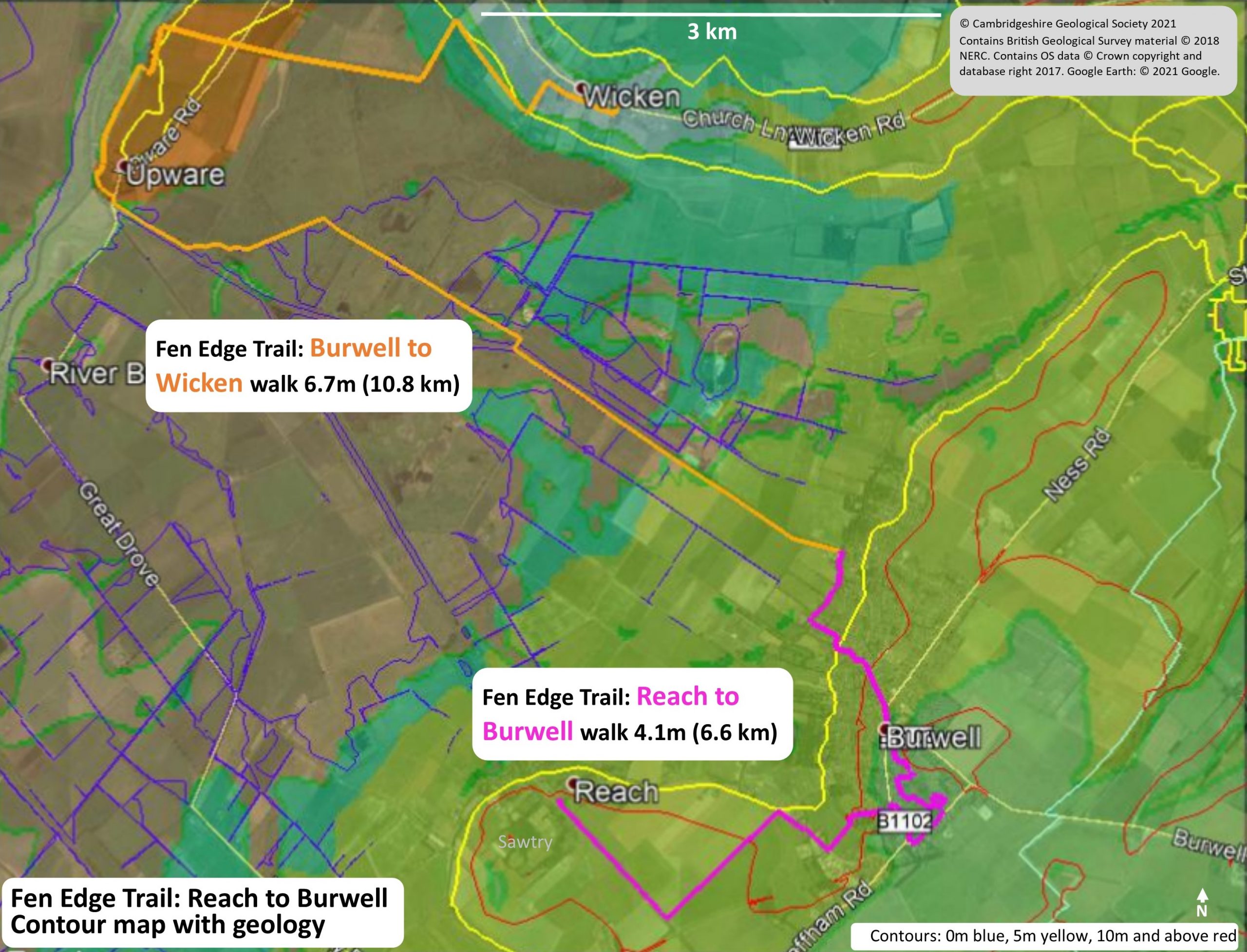
Two walks:
The next two walks on the Trail between Cambridge and Isleham (the Suffolk border).
1 (27) Reach to Burwell – published
Download the Walk Guide below
2 (28) Burwell to Wicken via Upware – due 2024

Walk 1 (27): Reach to Burwell
DOWNLOAD WALK GUIDE
‘This walk includes a wealth of past economic geology’
The route: ‘from the fen up onto the Chalk hills, and back down to the lodes’
4.1 miles (6.6 km) Walking guide time 2hrs 30mins plus stops
‘This walk includes a wealth of past economic geology’
The route: ‘from the fen up onto the Chalk hills, and back down to the lodes’
4.1 miles (6.6 km) Walking guide time 2hrs 30mins plus stops
In partnership with
Burwell Museum and Windmill
In partnership with
Burwell Museum and Windmill
Having travelled from Cambridge along the south eastern Fen Edge, this walk connects the two historic villages of Reach and Burwell. Rising out of the fen up towards the Chalk ridge, it meanders through a linear village and then takes you back down to the 5 m contour, ending by one of the famous fen lodes. You first walk along the Devil’s Dyke, an Anglo Saxon (7th century) defensive construction. This imposing rampart and ditch runs straight from the boggy fen up to the wooded Chalk highlands at Wood Ditton (7.5 miles from Reach), an important area with King Anna’s settlement in Exning nearby.
Having travelled from Cambridge along the south eastern Fen Edge, this walk connects the two historic villages of Reach and Burwell. Rising out of the fen up towards the Chalk ridge, it meanders through a linear village and then takes you back down to the 5 m contour, ending by one of the famous fen lodes. You first walk along the Devil’s Dyke, an Anglo Saxon (7th century) defensive construction. This imposing rampart and ditch runs straight from the boggy fen up to the wooded Chalk highlands at Wood Ditton (7.5 miles from Reach), an important area with King Anna’s settlement in Exning nearby.
The large village of Burwell is steeped in history, owing its success to the freshwater springs at the base of the Totternhoe Stone and the quarrying of this famous rock for building stone, lime and cement. Phosphate in the form of ‘coprolites’ was also mined from the Cambridge Greensand, a layer at the base of the Chalk that is now just below the surface of the Fen Edge, and the yellow brick came from the Gault clay pits to the west of the village. You visit two Local Geological Sites, seeing several springs and an accessible quarry into the Zig Zag Chalk. You also pass a ruined castle, a marvelous example of a perpendicular church and some very ancient houses. Look out for the informative black plaques erected by the Burwell History Society along the way.


Walk 2 (28): Burwell to Wicken
To be published 2024
Via the village of Upware and Wicken Fen Nature Reserve one of the most important wildlife sites of the Fen Edge.


© Cambridgeshire Geological Society