Two more walks on the Trail between Ramsey and St Ives, plus an additional round trip walk:
1 (11) Warboys to Somersham – published
in partnership with Warboys Archaeology Group
2 (12) Somersham to Earith via Colne – published
3 (12a) The Old Bedford and New Bedford (100 Foot) Rivers at Earith – published
in partnership with the Word Garden
Download Walk Guides below

Walk 1 (11): Warboys to Somersham
DOWNLOAD WALK GUIDE
’There are amazing views across the Fens from the high ’plateau’ at Warboys. You can even see Ely Cathedral on a clear day’
The route: ‘cross the fen under wide skies to the gravel peninsula of Somersham’
4.8 miles (7.6 km) Walking guide time 3hrs plus stops
In partnership with ![]()
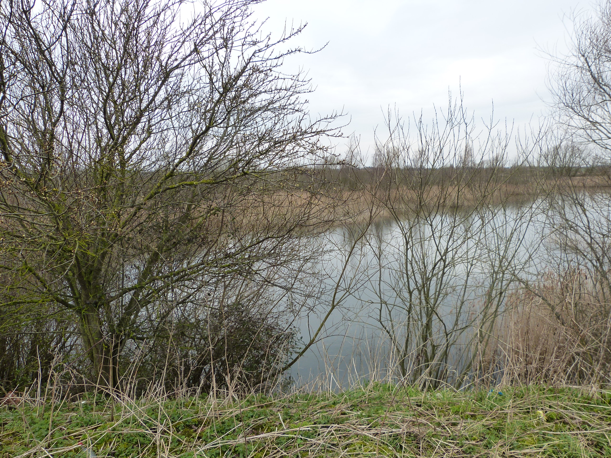
This walk, on the south western Fen Edge, is the third stage of the Trail linking Ramsey and St Ives. Having climbed up to higher land at Warboys, the route now descends again to the lower lying fen to head east to Somersham. Starting at about 32m above sea level in Warboys, the walk reaches as low as 1m about half way through, as you briefly walk on the edge of the Peat. Somersham is important for geological research as it has well-preserved sequences of River Terrace gravels from ‘the Ice Age’. These show the climate changing between cold and warm periods, the rivers changing course and the fenland being flooded by freshwater and the sea at various times. This large peninsula of well-drained gravels has provided a significant area for human settlement. The walk follows the Pathfinder Way and the Rothschild Way.


Landscape and Geology
In this area there are three general types of ‘rock’ currently at the surface. The oldest, underlying the lower ’fenland’, is Oxford Clay, which is c.160 million years old (from the Jurassic Period). An extensive sea covered this part of Britain at the time, the material deposited on the sea floor becoming compacted to form clay- it is famous for the fossils of marine reptiles such as Ichthyosaurs (one was found in Warboys Pit). Ampthill Clay is younger but also of Jurassic age, lying over the Oxford Clay—it is at the surface in Warboys and along the fen edge here. The third type of surface ‘rocks’ here are much younger, being from the current ‘Ice Age’ (the Quaternary Period, which started c. 2.6 million years ago). The oldest are glacial deposits (such as sands and gravels, river and slope material and finer ‘till’ from the Pleistocene Epoch). The higher land to the west is formed of this Glacial Till whilst the extensive gravel pits to the northeast of Somersham have made use of the material left by extensive rivers draining from the melting glaciers. The younger are from the Holocene Epoch (the last 11,700 years) and consist of three types: Alluvium (finer, river material) from channels within the wider Ouse Valley, Peat (formed in freshwater swamps), and small remaining areas of marine Silt (from tidal channels c.4,000 years ago when the coast was much nearer than it is today).


Geology and Archaeology at Somersham
The fen edge at Somersham has proved to be an important area for geological research due to its extensive gravel deposits of the River Terraces here (up to 7.5m thick), together with interbedded organic material. These hold a valuable record of environments during the current ‘Ice Age’ (the Quaternary Period) including the Pleistocene (Middle and Late) and Holocene Epochs. A channel cut in the Jurassic Ampthill Clay (by a previous course of the River Great Ouse) contains gravels from the end of the Tottenhill Glaciation in the Late Wolstonian cold stage (ending c.130,000 years ago) covered by loess (a fine, wind-blown material). Pollen studies show that there are also freshwater and marine-influenced deposits from the temperate (warm) Ipswichian stage (130,000 to 115,000 years ago) and more recent lake deposits from Lake Sparks, which formed at the end of the last glaciation, the Devensian ( c.20,000 years ago), when ice blocked the flow of water into the Wash to the north, causing an extensive lake to form in southern fenland. Lake sediments found here include red Hunstanton Till – carried from the Norfolk coast. Deposits of marine silt (the ‘Fen Clay’) in the area show that marine conditions reached the (wider) Ouse valley between Chatteris and Somersham, interrupting Peat growth. The date suggested by the deposits is c. 3,855 years ago, a few hundred years before the likely fullest extent of this (early Bronze Age) ‘sea incursion’.

Somersham’s gravels have provided archaeological finds such as 4 flakes (now at the Sedgwick Museum) and a handaxe (at the British Museum) probably from Station Pit, dated to the Lower or Middle Paleolithic. The finds include Levallois flints, usually associated in Great Britain with Homo neanderthalensis.
Walk 2 (12): Somersham to Earith
DOWNLOAD WALK GUIDE
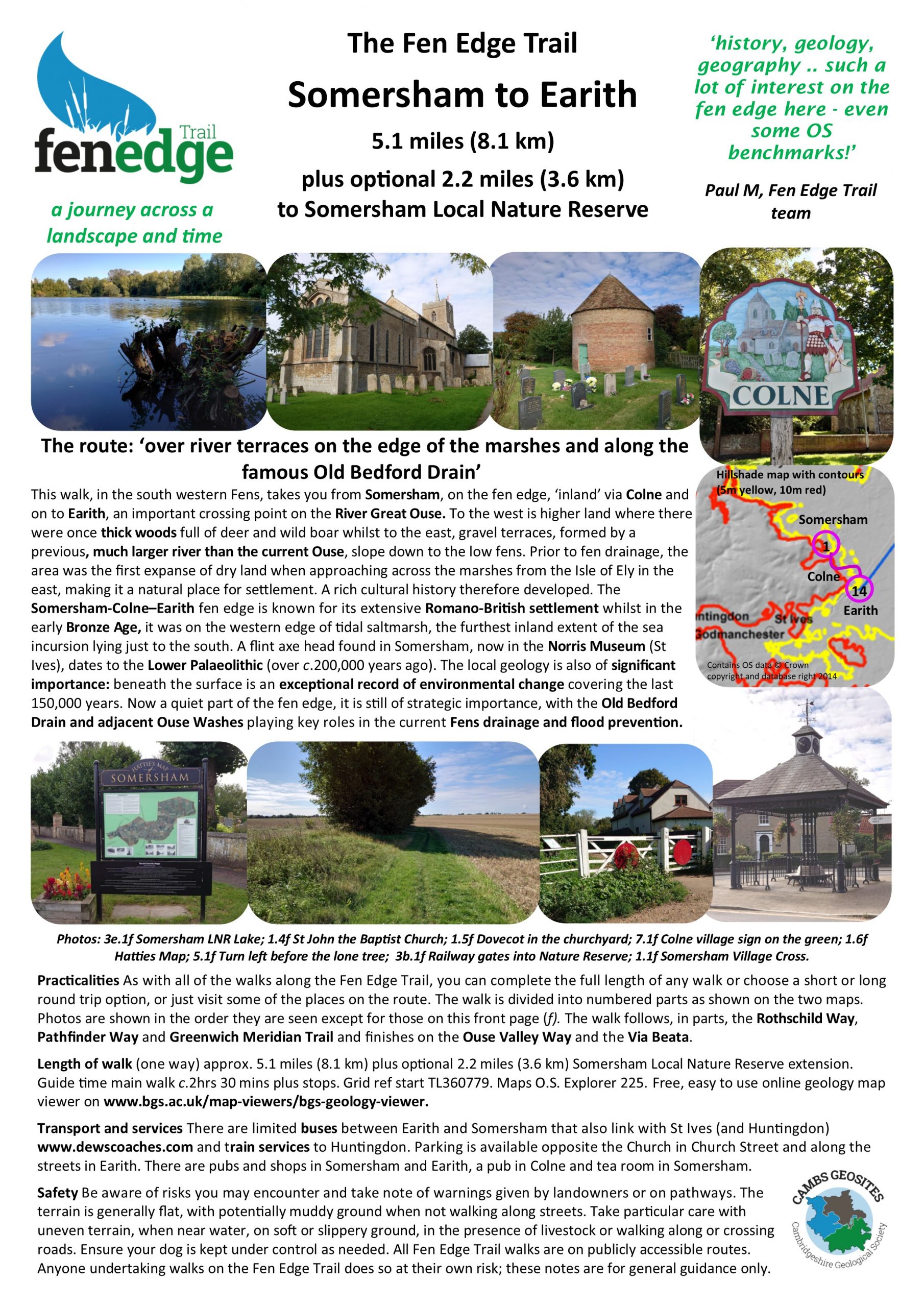
‘history, geology, geography .. such a lot of interest on the fen edge here – even some OS benchmarks!’
The route: ‘over river terraces on the edge of the marshes and along the famous Old Bedford drain’
5.1 miles (8.1 km) Walking guide time 2hrs 30 mins plus stops
This walk, in the south western Fens, takes you from Somersham, on the fen edge, ‘inland’ via Colne and on to Earith, an important crossing point on the River Great Ouse. To the west is higher land where there were once thick woods full of deer and wild boar whilst to the east, gravel terraces, formed by a previous, much larger river than the current Ouse, slope down to the low fens. Prior to fen drainage, the area was the first expanse of dry land when approaching across the marshes from the Isle of Ely in the east, making it a natural place for settlement. A rich cultural history therefore developed. The Somersham-Colne–Earith fen edge is known for its extensive Romano-British settlement whilst in the early Bronze Age, it was on the western edge of tidal saltmarsh, the furthest inland extent of the sea incursion lying just to the south. A flint axe head found in Somersham, now in the Norris Museum (St Ives), dates to the Lower Palaeolithic (over c.200,000 years ago). The local geology is also of significant importance: beneath the surface is an exceptional record of environmental change covering the last 150,000 years. Now a quiet part of the fen edge, it is still of strategic importance, with the Old Bedford Drain and adjacent Ouse Washes playing key roles in the current Fens drainage and flood prevention.


When designing the Somersham to Colne section of this walk, Paul put together a video which you can watch on YouTube.


Landscape and Geology
In the last few thousand years (the Holocene), Peat formed on top of the gravels in lower areas when (fresh) waterlogging lasted long enough for the build up of this organic material. The river now called the River Great Ouse has had a dynamic history with its course changing numerous times, particularly since Man has had such a dramatic impact on the fenland landscape. Alluvium, a fine material deposited relatively recently by the river, particularly in times of flood, extends over the current Ouse river valley and also in other areas, showing the location of old water channels that have now disappeared. From Earith, the main river once flowed north, to the west of Chatteris and then on to the Wash. Called the West Water, this course can be seen by the significant band of Alluvium that covers the Peat and River Gravels to the east of this walk. The rest of the flow entered the Old West River modified and enlarged, probably during the Middle Ages, to go east to join with the Cam and then north to the Wash.

Walk 3 (12a): The Old Bedford and 100 Foot (Earith)
DOWNLOAD WALK GUIDE
More details on the The Word Garden page
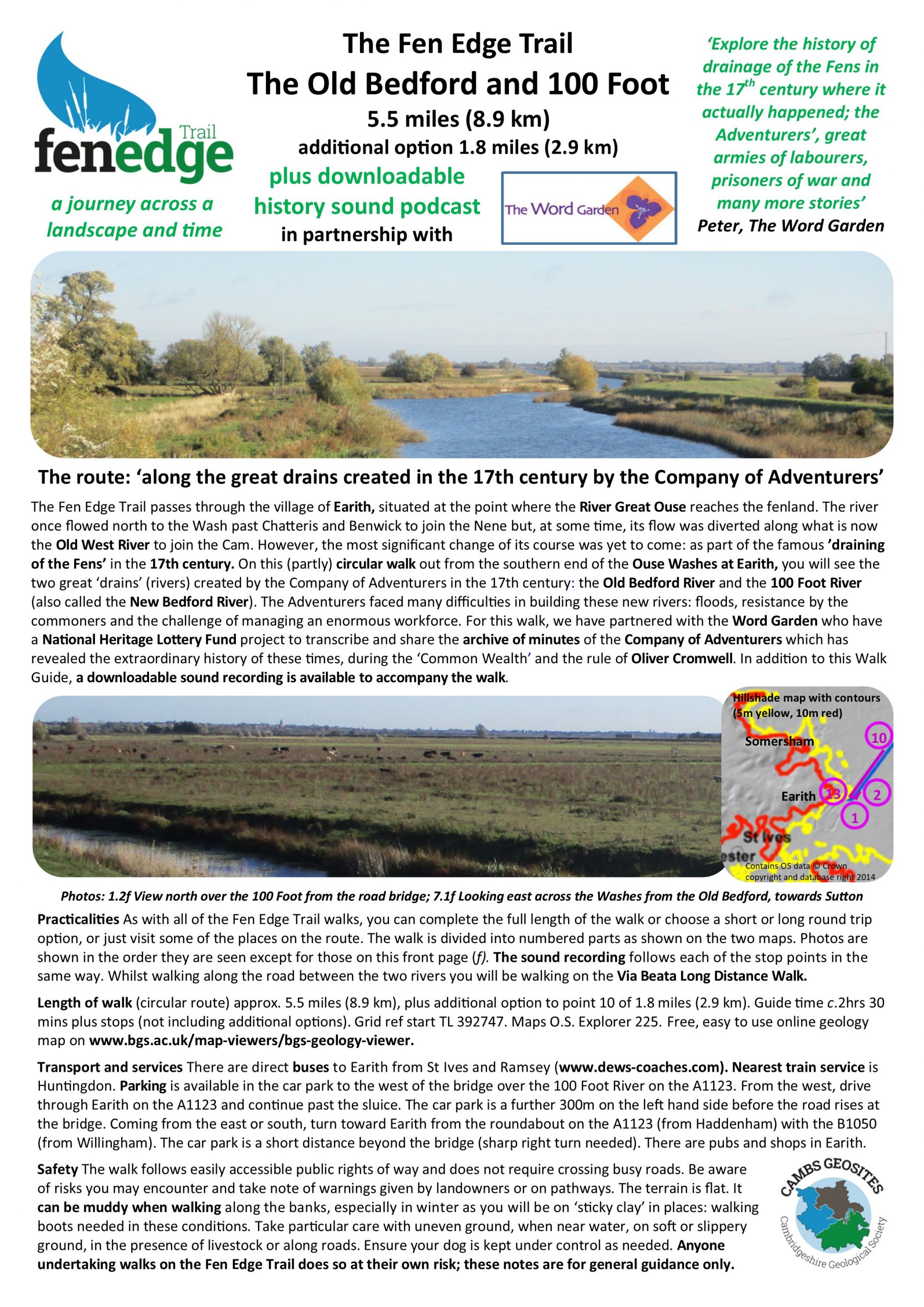
We have worked in partnership with the Word Garden as part of their ‘Adventurers‘ project to design a walk at the southern end of the Ouse Washes at Earith. To accompany the Walk Guide, the Word Garden have produced a downloadable audio podcast that you can listed to while you walk
More details on the The Word Garden page
We have worked in partnership with the Word Garden as part of their ‘Adventurers‘ project to design a walk at the southern end of the Ouse Washes at Earith. To accompany the Walk Guide, the Word Garden have produced a downloadable audio podcast that you can listed to while you walk.
The walk tells the story of the creation of the 100 Foot River, also known as the New Bedford, in the 17th century and explains how this major drain, the parallel Old Bedford drain and the Ouse Washes between them provide, even now, the major flood prevention scheme in the Cambridgeshire Fens. For details of the walk see The Word Garden.
© Cambridgeshire Geological Society


