
@FenEdgeTrail
A journey across a landscape and time
Guided Walks
We occasionally organise guided walks on the Trail, led by our volunteers. We hope to have a couple of these n 2024 – look out for details here and on our X (was Twitter) posts.
Join us for guided landscape heritage walks to discover the link between geology and local culture. All trips require booking. Places are limited on each trip. Everyone is welcome. Children (under 18) are welcome on all trips but must be accompanied by an adult. None of the walking is strenuous. Unfortunately, most walks are not wheelchair accessible – please check with us.
News May 2024: Four new Walk Guides published
The following four new Walk Guides can now be downloaded. Either download each of them from their area page by following the links below or all of them from The Walks page:
4 Stanground to Yaxley via Farcet
8 Wood Walton to Ramsey via Upwood and Bury
15 St Ives to Swavesey via Fen Ditton and Fen Drayton
20 Milton to Cambridge via Chesterton
The following four will be published soon:
3 Peterborough to Stanground
28 Burwell to Wicken via Upware
31 Fordham to Isleham
37 Wilburton to Stretham with add on to Stretham Old Engine
Others will follow later in 2024 including:
6 Holme to Sawtry
19 Waterbeach to Milton via Horningsea
29 Wicken to Soham
38 Stretham to Ely via Little Thetford
")


Find a Fen Edge Trail walk
See the Walks page for a list of all the Fen Edge Trail walks and download the Walk Guides that are already published.

January 2023: Walk published
Thorney ‘island’
‘an iconic fen island – monks, marshes and a model village’
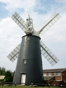
Thorney, the ‘Isle of Thorns’, was a fen island surrounded by marshes until the drainage projects of the 17th century. It has been known since the 7th century for its major Benedictine Abbey; the large Abbey church remains impressive, even though much of it was lost in the 16th century. The Victorian village is of the characteristic local brick and is famous for being a ‘model village’, built in the 19th century under the Duke of Bedford’s ownership.Not far from the City of Peterborough, this easy walk takes you through an historic fenland village and quiet countryside with plenty of wildlife, giving a taste of the iconic landscape of the Fens.This walk is a good introduction to the geology of the northern part of the Cambridgeshire Fens, including silt from extensive tidal marshes and ancient river beds (roddons), the River Terrace Gravels of the Nene and the complex ’March’ Gravels. The latter created the island itself, raising it above the low fenland; these gravels also form the islands of Whittlesey, March and Chatteris.
The Fen Edge Trail walk around Thorney has been designed in partnership with Thorney Museum and the Thorney Society. Thanks to Dot from Thorney Museum for her work on this walk.


News December 2022:
4 new walks published
Download the Walk Guides from The Walks Page
December 2022 saw the publication of 4 new Walk Guides including two with a difference: we have now expanded into the realms of podcasts and YouTube videos! Thanks to Paul S, Jeff and Paul M, respectively, for their work in putting the first three walks together and to Paul M for the YouTube videos of his exploits when researching the route! The 4th walk is published in partnership with The Word Garden as part of their Adventurers project and has an accompanying downloadable podcast.


Sawtry to Wood Walton
‘follow in the footsteps of the monks’
The first of these four walks starts in Sawtry, named after salt, once a precious commodity made in the Fens. It passes the site of Sawtry Abbey and then visits the iconic (and once deserted) church of St Andrew’s situated on a lonely hill north of Wood Walton before finishing at the village green. The geology is nearly all Oxford Clay (including the hill!) except for a patch of Peat in Sawtry Fen that fills a bay formed by periglacial (freeze/thaw) effects during the last glaciation. The walk was developed in partnership with the Great Fen Heritage Group as it passes the south western corner of the Great Fen, a wildlife-rich area that includes Woodwalton Fen National Nature Reserve, It is the first walk on the western fen edge to be published.


Haddenham to Wilburton
‘on the Isle of Ely: from the high ridge, along the ancient causeway to the river’
The second walk is the third to be published on the Isle of Ely, following on from the walks from Witcham to Mepal and then Sutton on to Haddenham. From the heady heights (38 m OD) of the centre of Haddenham, it takes you via Aldreth and the Old West River to Wilburton, crossing seven types of geology in total! This is a lovely area, full of history, and with views down from the high Kimmeridge Clay, Woburn Sands and Gault clay ridge that runs east to west along the south of the Isle of Ely. The walk follows the Aldreth Causeway as you descend onto Ampthill Clay and cross the Terrace Gravels of the Ouse ‘system’ as well as Peat and Alluvium near the river. It is in the area where the ‘New Life in the Old West’ project is running and we hope to work with them in the future to arrange joint walks.
Somersham to Earith
‘over river terraces on the edge of the marshes and along the famous Old Bedford drain’
The third walk is the penultimate walk to be published of the 6 walks that link Ramsey with St Ives. Starting in Somersham, where the walk from Warboys finishes, it takes you via Colne and on to Earith, the start of the walk along the river valley to Needingworth. Only the final section, from Needingworth to St Ives remains to be published. After a pleasant walk through fields and along farm tracks to Colne, you pass through the Somersham to Earith fen edge which is now a land of flooded sand and gravel pits but was once the first dry land after travelling west from the Isle of Ely. It is an area that has seen significant (Pleistocene) geological research and there have also been important archaeology finds here. The bedrock here is Ampthill Clay (younger than the more famous Oxford Clay that outcrops to the north west) but it is mostly covered by Terrace Gravels and more recent Alluvium that, together, tell part of the complex local history of the Ouse; once an extensive delta emptying into the Fen Basin and later its single channel transformed by fen drainage.


Earith: The Old Bedford and 100 Foot
In partnership with The Word Garden
To accompany this walk, a sound recording can be downloaded onto your phone so that you can listen to it as you walk.
The fourth walk is a detour from the main Fen Edge Trail route: a (partly) circular walk focusing on a particular aspect of the landscape, accompanied by a podcast that describes the associated history. We have partnered with the Word Garden who have designed the route and produced the podcast as part of their ‘Adventurers’ project (run by Peter Daldorph and funded by the National Lottery Heritage Fund) about the drainage of the Fens in the 17th century. From Earith, you walk out along the banks of the New (the 100 Foot) and Old Bedford Rivers to see the southern end of the extensive Ouse Washes (the land that lies between them). This is an interesting area, just to the east of the Somersham to Earith walk and to the west of the Sutton and Haddenham walks on the Isle of Ely, with a fascinating geological and cultural history. As you walk, the Guide (and the downloadable podcast) explain how the construction of these two major drains was accomplished, how they changed the landscape and how they still provide the main flood prevention scheme in the southern Fens.


Our partnership with The Word Garden
We were delighted to support the Word Garden in their ‘Origins’ project which tells the story of the involvement of Scottish prisoners in the draining of the Fens. In the 17th century, many prisoners taken by Cromwell’s army at the Battle of Dunbar ended up as forced labour to dig the 100 foot (New Bedford) River from Earith to Denver. This fascinating project brings history, science, art, drama and communities together to bring to life a little know aspect of the fenland landscape’s past, Our Fen Edge Trail walk at Earith is a follow up to our support of the Origins project which included a book (downloadable), a celebration day in 2019 (including a live performance of ‘Dunure to Denver’) and a film of the story,


Explore the Landscape Heritage
of the Cambridgeshire Fens
on a series of walks around the Fen Edge
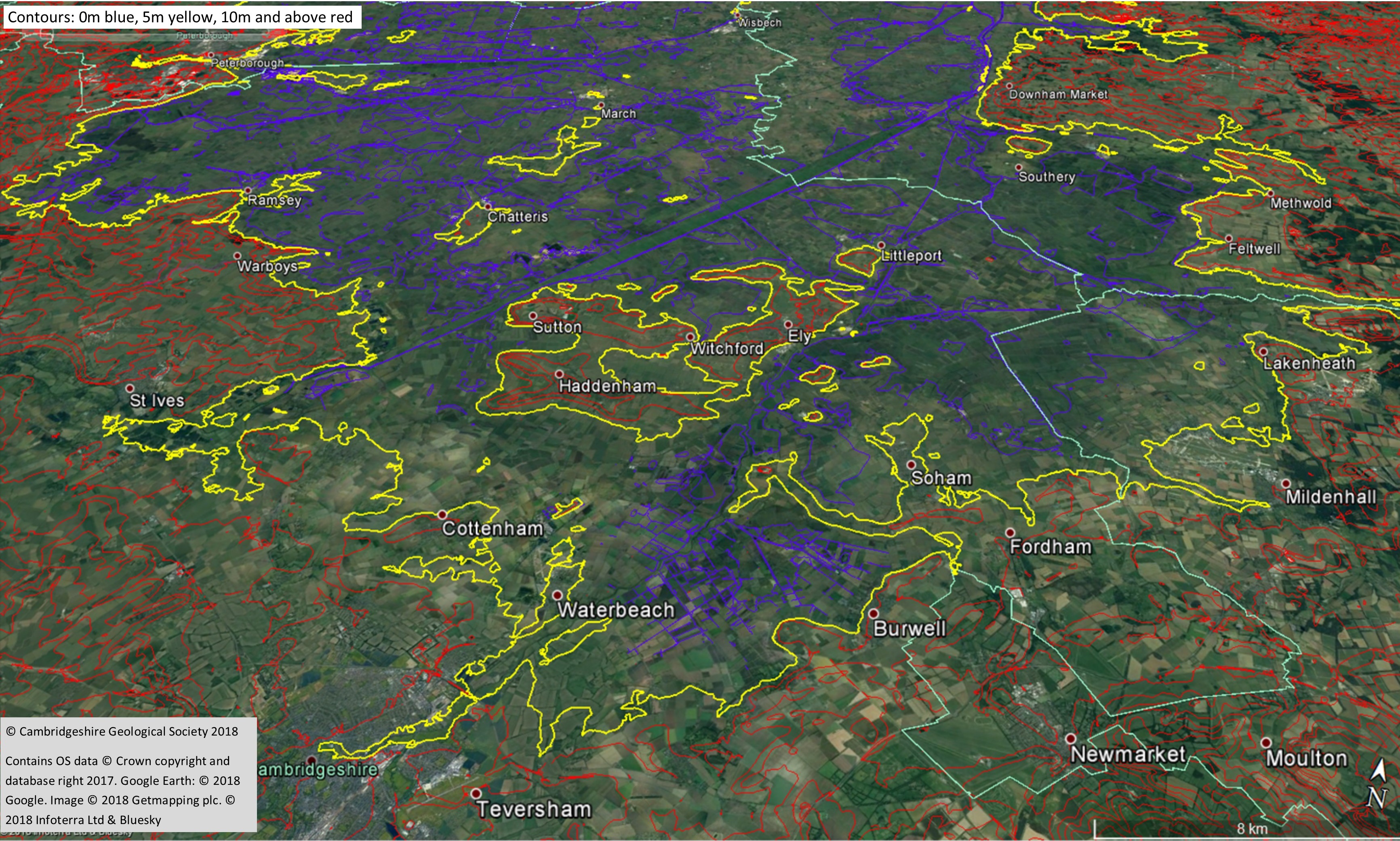
The Fen Edge Trail takes you from the Lincolnshire border in the northwest of the county to the Suffolk border in the southeast, roughly following the ‘edge’ of the Fens (including the islands) where the land rises to 5 metres above sea level (the 5 m contour). We are gradually publishing a series of Walk Guides that take you on easy walks with an average distance of about 5 miles each, although some can be done in shorter sections or you can combine them to make a longer walk. The Walk Guides not only provide a map and directions but also describe the landscape, geology, history and wildlife along the route. Even if you do not wish to walk very far, you can read the Guides to find information on places of interest that can be visited in each area and the relevant webpage has links to organisations and sites that will help you discover more. The links between geology, ecology, history and present day life in the Fens reveal themselves and the more you look, the more you discover and the more fascinating it becomes!
Landscape Heritage
of the Cambridgeshire Fens
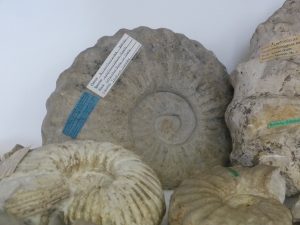
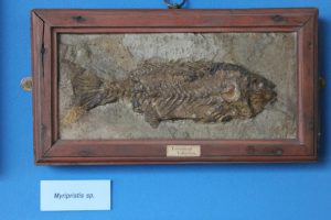
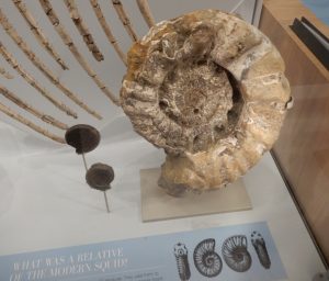
The Cambridgeshire landscape has a unique and fascinating history, from floods and glaciers to deep seas, tropical lagoons and even volcanoes! The Fen Edge is where low-lying fenland meets the surrounding ‘highland’, roughly where the land lies 5 metres above current sea level. This is thought to be the approximate maximum extent of the once extensive wetland. Sea level has, however, changed greatly at various times and the amount of freshwater flooding, from rivers and meres, has changed even more frequently, often not only from season to season but from year to year. Although the draining of the Fens is well-known, the story of how and when this happened is far more complex than is generally thought. The Fen Edge, including the many fen islands, provided drier land that was often a refuge from the marshes and it is, therefore, here where much of the history of the fens can be discovered by looking at the clues that remain.
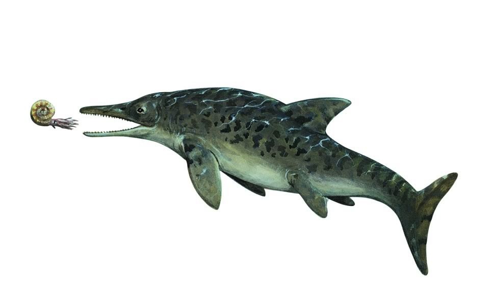
As well as a rich cultural history, the Fens also have a fascinating, and often dramatic, landscape heritage, which is far less well-known but that continues, even today, to affect the lives of its inhabitants. From volcanoes to ‘ice ages’, and salt marshes to raised bogs, from Jurassic sea ‘monsters‘ to mammoths, and hippos to bog ‘oaks’, the complex story of how the fens were formed and what and who lived here, can be discovered by exploring the Fen Edge.
Partnership
The Fen Edge Trail is an initiative set up by the Cambridgeshire Geological Society as part of our Geosites work. Our partners in developing the Trail are several local organisations who are each exploring their local landscape to contribute to the project. we have wrked with a number of other local organisations on various walks. These include Fenlandia, the Great Fen, the Great Fen Heritage Group, Huntingdon and Peterborough Local Groups of the Wildlife Trust (Beds, Cambs and Northants), Warboys Archaeology Group, the Word Garden, the RSPB (Ouse Fen and Fen Drayton), Chatteris Museum, Discover Ramsey, Burwell Museum, Thorney Heritage Museum, Holme History, the Isleham Society and Wicken Fen (National Trust).
If you or your group would like to get involved in the Fen Edge Trail, please contact us. You may like to contribute information on local history, landscape, farming, wildlife or culture or you could help with designing one of the walks.


")


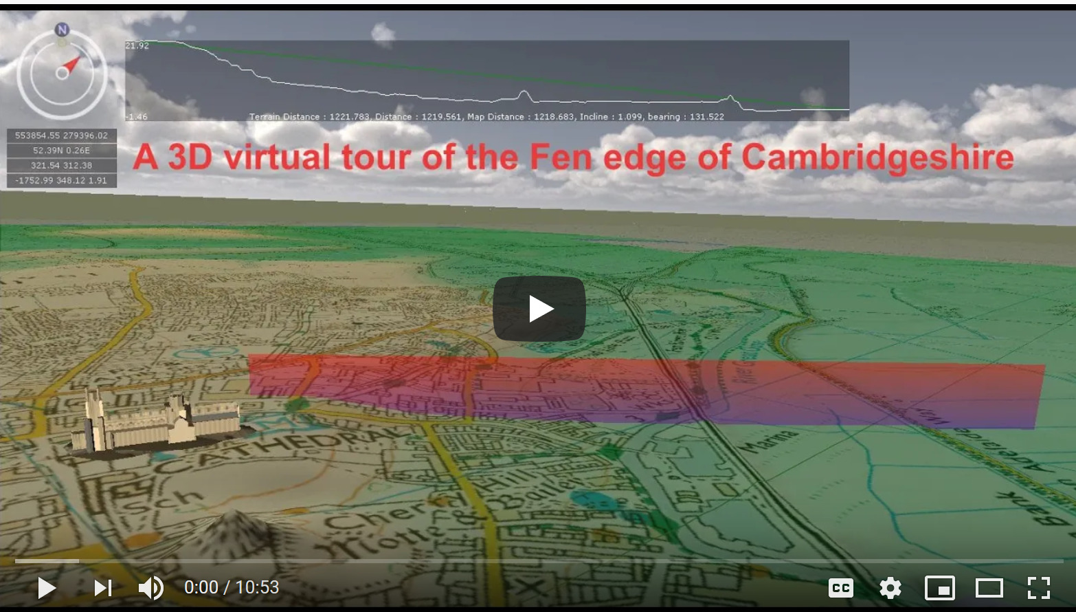
A ‘flyover’ of the geology of the Isle of Ely
For a fascinating ‘flyover’ of the geology of the Fens, see this virtual tour around the Isle of Ely (using GeoVisionary software) produced by Cranfield University for us. Read more about the Landscape and Geology of the Fens here.
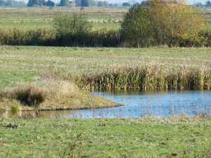
The Sea in the Fens – the salt marshes and tidal creeks (roddons)
As part of Celebrate the Fens Day 2020, we published a new webpage of information on how the sea has left its mark on the the Fens in the form of roddons – ghost-like patterns of fossilised water channels that appear in many fenland fields. We would welcome any photos you have of apparent roddons, especially if they can also be seen in aerial photographs (such as on Google Earth). More here


If you would like to get involved in the project or receive our emailed updates and news, please contact us.
© Cambridgeshire Geological Society